.JPG) This monument was erected in downtown Dawson Creek. It's the "0" Mile Marker to the Alaskan Highway. Starts here in Dawson Creek and ends in Delta Junction, Alaska. The highway is approximately 1,400 miles long and was built by the United States in just 9 months. We will start our journey on the Alaskan Highway. Our first stop will be Fort Nelson. We'll be going all the way, so stay tuned.
This monument was erected in downtown Dawson Creek. It's the "0" Mile Marker to the Alaskan Highway. Starts here in Dawson Creek and ends in Delta Junction, Alaska. The highway is approximately 1,400 miles long and was built by the United States in just 9 months. We will start our journey on the Alaskan Highway. Our first stop will be Fort Nelson. We'll be going all the way, so stay tuned.Tuesday, May 28, 2013
Downtown "0" Mile Marker in Dawson Creek
This monument was erected in downtown Dawson Creek. It's the "0" Mile Marker to the Alaskan Highway. Starts here in Dawson Creek and ends in Delta Junction, Alaska. The highway is approximately 1,400 miles long and was built by the United States in just 9 months. We will start our journey on the Alaskan Highway. Our first stop will be Fort Nelson. We'll be going all the way, so stay tuned.Canadian Rockies, Dawson Creek "0" Mile Marker
 We started our trip from Prince George with a cool 47 degrees. It was a moderate sprinkle for a long ways. But, we had beautiful views of the Canadian Rockies.
 There was still quite a bit of snow on the Rockies. This area is great for skiers in the winter. There were some beautiful waterfalls cascading down the mountainsides into the rushing rivers along the highway.
.JPG)
 This historical marker is one of the most photographed places on the continent. This is Mile "0" of the Alaskan Highway. Construction started in 1942 and completed in just 9 months to build an access from the Continental United States to Alaska. This highway was built by the United States and is now maintained by Canada.
 We visited a couple museums in Dawson Creek. This is a picture of a US Jeep used in the building of the Alaskan Highway. Sometimes the road had to be built on logs.
 Another museum we visited had several displays of the wild animals found in the area. Bob is petting a wolf. There is a grizzly bear, fox, mountain goat, badger, and beaver. Owls in the next exhibit.
Monday, May 27, 2013
Canada
 Our first experience with Canada was not a pleasant one. We were sustained over 2 1/2 hours at the border. They took our keys and inspected our trucks and then our RVs. They opened cupboards, drawers and even looked under our beds and in closets. We all passed eventually, but it was a trying experience. It took us that much longer to arrive at our intended destination. Once we got started, the scenery was awesome.
  Beautiful rock formations and blue, after bluer mountains.
 There were areas of pure rock with no vegetation.
 Lots of trees lining the highways with mountains in the distance.
 The higher mountains had snow caps.
 We had to go through several tunnels carved through the mountain.
  We followed rivers with long, long, long trains.
 This was the view from our first campsite in Spencers Bridge, British Columbia. There were big trains passing every few minutes. I thought they would keep us awake during the night, but we were all so exhausted, we never heard them.
  In the valleys between the mountains we saw rich farmlands. This field was painted with dandilions. They grow lots of fruit and vegetables.
 Friday, May 24, 2013
Columbia River/ Skagit River
 Still in Oregon, we were on I-84 all along the Columbia River Gorge. It was a beautiful ride. The Columbia River is wide and picturesque.
 On the other side of the Columbia River is the state of Washington. It is a beautiful state. At this time of the year there is so much color with the Lilacs, Rhododendrons and other shrubs. We just missed the tulips that Washington is famous for.
 We have spent 5 days in Mt Vernon, WA. This bridge on I-5 collapsed last night. We had crossed this bridge a couple of times. I'm sure glad it didn't happen to us. Apparently an over-sized load hit part of the bridge and caused the collapse. The semi made it across okay, but the 2 vehicles that followed came down with it. No one died, but it is a huge inconvenience to detour this part of the interstate. We have to take I-5 into Canada, so we will take the detour.
  Part of the bridge collapsed taking a pickup truck and car with it.
  This young man stayed on top of his car waiting for rescue. I'm sure the water is pretty cold. It's only in the 60's here.
 Rescue boats came to get the young man in the car and a man and woman in the pickup. I'm sure it will take a long time before this bridge is replaced.
 Friday, May 17, 2013
The Awesome, mysterious Crater Lake, Oregon
 On our way to Crater Lake, we pulled off to view this unique rock formation in the canyon called Fossil Fumeroles.
 When Mt Mazama's volcanos erupted, the gases were so hot (750 degrees) that these fumaroles were formed.
  This is the beautiful Crater Lake. It's creation is not what you would think. About 7700 years ago this area was Mount Mazama. When a huge volcano erupted, it caused a total collapse of the mountain, creating a huge crater 7 miles wide. It's beautiful deep blue water is considered to be the clearest and cleanest in the world.
 We drove around to see different views of this awesome wonder. Crater Lake is the deepest body of water in the United States.
 This is a volcano in the middle of Crater Lake called Wizard Island.
 Not long after we arrived, a thick cloud started to cover the whole lake. We were glad that we didn't sleep in and miss it's beauty.
 Today is May 17th and there are still huge drifts of snow everywhere. This area is one of the snowiest places in America, averaging 44 feet of snow annually.
 We all had fun throwing snowballs at each other. The snow was damp and just right for snowballs. If you look closely, you can see Sue's snowball to the left of Shin. She missed her by a mile. She throws like a girl!
Wednesday, May 15, 2013
More Redwood Forest and Battery Point Lighthouse
 Jack took us on a different tour of the Redwood Forest. It wasn't so well traveled and the road wasn't paved, but we really enjoyed the adventure. The untouched forest was awesome, and I enjoyed the different flora of the forest.
 The road at times seemed too narrow for Jack's big truck to pass through, but we made it through every passage.
 Jack had his T-top open for us to view the massive height of these awesome trees.
 We came across a tree that was hollow. Joe decided to climb inside. When he got inside, all of a sudden he screamed---"There's something in here!!!!" He pretended to be being dragged in by some horrible creature. Very funny, Joe.
 It didn't scare me. I too decided to venture inside. Once you get inside, it's quite spacious, and you can stand up and walk around. It was hollow all the way to the top.
 Since it was not high tide, we decided to visit the Battery Point Lighthouse. The landscape was beautiful. The keepers and tour guides are all volunteers. They stay a month at a time there. We had a full tour all the way to the top. There is a lot of history in this lighthouse built in 1856.
 Bob took this picture while we were way up to the top. What an awesome view from all the windows. Our campsite is in the distance on the left side by the tree. I learned a lot about lighthouses. It was a great tour.
Tuesday, May 14, 2013
Crescent Beach & Redwood Forest
 This is the Battery Point Lighthouse. I took this shot from our campsite in Crescent City, California. Built in 1856, it held it's ground against seismic waves from the 1964 Alaska earthquake, which claimed 11 lives in Crescent City and wiped out 29 blocks of commercial and residential structures. It is manned with a keeper and curator and can be accessed by foot on low tide. At high tide, Battery Point becomes an island.
 We spotted this pack of seals on Crescent Beach, sunning and barking and fighting each other for position on the dock.
 Of course, we are right on the Pacific Ocean coast. It's a peaceful and beautiful ocean unlike the Atlantic Ocean we are familiar with in Florida.
 This was the first big Redwood we ran across. We don't know the dimensions, but it was big!
 Bob's outstretched arms is 5 feet, so you can see how big the tree is.
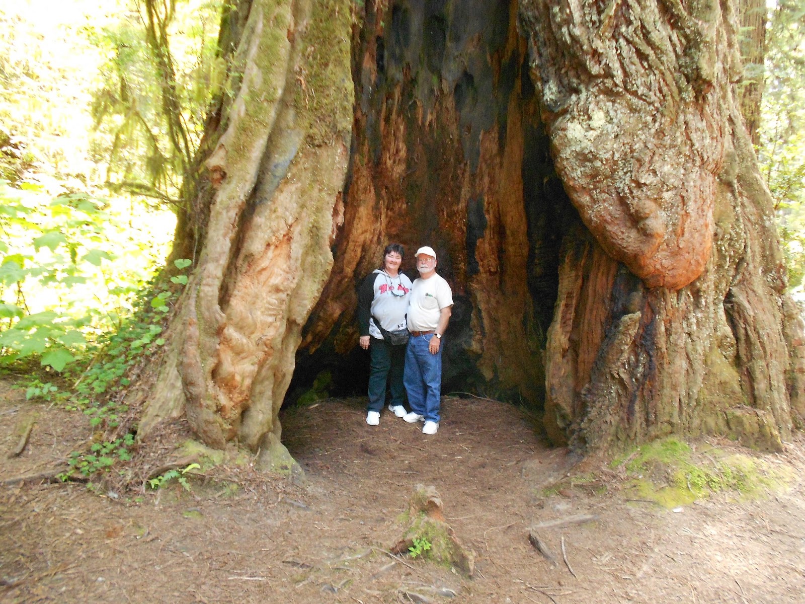 This huge tree is hollow, but still very alive.
 This is the biggest tree we saw today. It is 304 feet tall, 21.6 feet in diameter, 68 feet circumference and estimated to be 1500 years old.
 This tree was big enough to drive your car through. It's still very alive, too.
Sunday, May 12, 2013
Mt Shasta in Weed, California
 We were 80 miles away when we first saw this beautiful snow-capped mountain.
  This picture was taken about 15 miles away.
.JPG) This is the view of the magnificent Mt. Shasta from our campsite.
This is the view of the magnificent Mt. Shasta from our campsite. Right next to Mt. Shasta is Black Butte.
 The Grand Sierra Resort and Casino in Reno, Nevada
 We enjoyed the original casinos downtown, but this casino had a huge RV park. We were within walking distance, but the hotel provided shuttle service which Bob and I took advantage of.
Friday, May 10, 2013

 Bob and I stopped in several of the biggest casinos. We played a while, and walked out small winners in almost all of them. It was a lot of fun. This is the ELDORADO Casino. We won here too.
 This huge clown stands outside the Circus Circus Casino. There is a huge midway inside. There were lots of families with kids in this casino. We won some here too.
Downtown Reno is not at all like the newer casinos like the won we are camping near called the Grand Sierra Resort. We really liked it downtown. We walked in one casino after another and had a great day.
Subscribe to:
Posts (Atom)